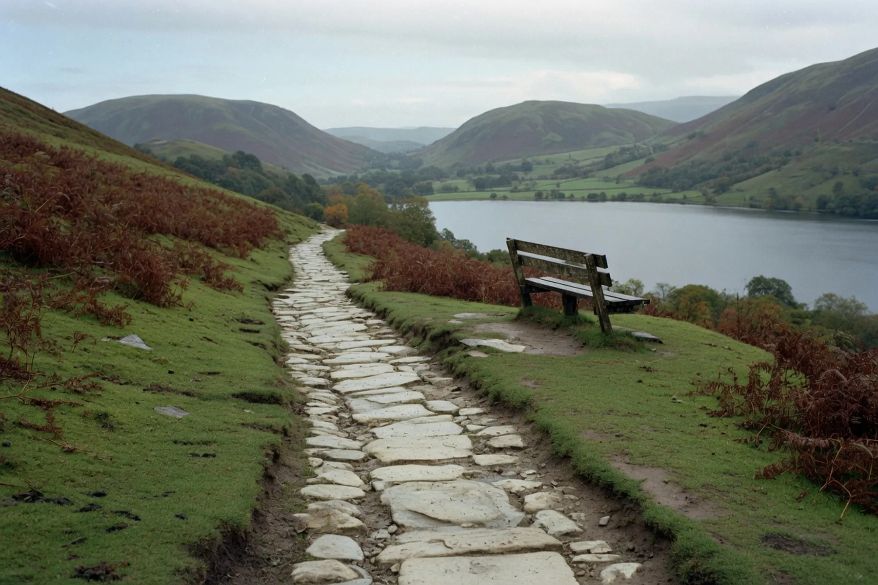
Latrigg is the grassy fell that sits immediately behind Keswick, the last low hump of the Skiddaw massif before the ground drops into town. Keswick Tourism Association puts the top at 368 metres. You do not come for the height. You come because from a bench on the south side you can see the rooftops, Derwentwater laid out to Borrowdale, and, on a clear day, the high mountains at the head of the valley.
There are two honest ways to do it: a short walk from the Gale Road car park on the National Park’s limited-mobility path, or a climb from the market square via Spooney Green Lane. They are not the same outing.
The Lake District National Park publishes the Gale Road line as Miles Without Stiles 38: a made path from a small car park at the head of the lane, 1 kilometre each way, listed at half an hour, graded “for some”. The map is OS Explorer OL4. There are no toilets or cafés on the hill; those are in Keswick.
Keswick Tourism Association’s walk from the Moot Hall is the other start: 3 miles, two to two and a half hours, out through Fitz Park and up Spooney Green Lane, with a circuit around the top. That is the walk if you are already in town and want the climb. A longer KTA line via the old railway path and Brundholme Woods runs to about 6.5 miles and two and a half to three hours — still Latrigg, not the short summit people mean when they say they did it from the car park.
Drive the A591 towards Bassenthwaite and come in through Applethwaite or Ormathwaite. The National Park’s start is the car park at the head of Gale Road: postcode CA12 4PH, grid NY 281253, what3words ///visitor.whisker.partner. Read the board. The same bays are the usual start for Skiddaw, which is why they fill.
Go through two gates at the head of the car park, signed for the Latrigg limited mobility path. The first 150 metres are the problem: a 1-in-7 gradient on well compacted stone. The Park does not recommend this stretch for people operating their own wheelchairs. Mobility equipment has to climb that slope and control the descent; scooters on the route must be class 2 or 3. The current note is on the Latrigg Miles Without Stiles page.
There is a rest as the gradient eases to 1-in-10. Look back here: Skiddaw, Lonscale Pike, the western end of Blencathra. The path then drops slightly to a junction with a public footpath, then rises again at about 1-in-10 to a small plateau and a bench. The grade is “for some” in the Park’s four-step system — some walkers, and confident pushchair, wheelchair and scooter users with robust all-terrain kit — not a “for all” lakeshore path. Conditions change after rain; check that page before you set out.
This is the fact other write-ups blur. The Miles Without Stiles turning point is the bench, grid NY 276246. From it, Derwentwater and Borrowdale open in front of you. On a good day the Park says you should see Scafell Pike, Great End and Great Gable at the head of the valley, with Helvellyn away to the left.
The summit of Latrigg is close, but the path on to it is steep and uneven. The published accessible route stops at the bench. You retrace to the car park; take care on the 1-in-7. KTA’s town walk does continue to the summit and then drops to the same bench — that is a walking line, not the limited-mobility one.
KTA notes that the bench is often windy and is not always the place for a picnic. The view is the point: town, lake, Borrowdale, Skiddaw at your back.
Leave the market square between the Royal Oak and Greggs, as KTA has it. Station Street, over the Greta, steps down into Fitz Park. Across the park past the BMX track, out onto the metalled road, then left up Spooney Green Lane, a public bridleway signposted Skiddaw.
The path crosses the A66 on a footbridge. After the gate the ground steepens; KTA calls the next 500 metres the steepest part of the walk. It eases. You pass a plantation with Skiddaw filling the view to the left. Ignore, on the way up, a path to the right signed Latrigg summit 3/4 mile — that is the way you will come down. Keep on as the path zigzags to the Gale Road car park, then take the limited-mobility gate and fork left on the gravel that becomes grass, up to the top, then right to the bench.
The descent can be muddy — KTA’s own caution. Waterproofs and shoes with a sole are the minimum even when the town pavement is dry.
KTA’s railway-path circuit starts at the war memorial (///tadpole.florists.stun): Station Road, past the leisure pool, onto the old railway line, through a tunnel, then up through Brundholme Woods. Down the other side you rejoin Spooney Green and Fitz Park. About 6.5 miles, two and a half to three hours — a better choice when you want the day to be a walk rather than a dash to a view. The railway trail itself is also Miles Without Stiles 37, a separate, level outing if the fell is out of the question.
Gale Road is small, and it is also the start for people going on up Skiddaw, so on a fine weekend it is gone early. If it is full, do not wait in the road. Drive back into Keswick and walk from town.
Town parking is pay-and-display. Cumberland Council’s Central long-stay park is the large one; Lakeside and Otley Road are the others most visitors use. Charges change. Read the tariff on the council’s Central page or the machine, not a screenshot from last year. More on the layout, the disc streets and the charge points is in our parking guide.
There is no published bus to the Gale Road car park. If you came without a car, the town start is the walk.
Castlerigg Stone Circle sits east of town on Castle Lane, a different direction from Latrigg. English Heritage: free, open in daylight, a ring of 38 stones, probably late Neolithic. The walk from the centre is about thirty minutes. The lay-by is tiny. Dogs on leads; the field is grazed. The ground among the stones is often muddy. Do not climb on them.
There is no official path that joins the two as one walk. What works is a half-day from a single town parking space: Latrigg out and back on Spooney Green, then Castlerigg on foot from the square — or the circle first if you want it empty. Driving Gale Road and then Castle Lane is two short drives and two small parks, both of which fill. Walking from town solves both. English Heritage asks people to consider the bus; Stagecoach serves the area — check the current services rather than a remembered number.
The mountain forecast and the town forecast are different things, even on a hill this low. Latrigg sits under Skiddaw’s cloud more often than the square does. Carry a waterproof anyway. The compacted stone on the limited-mobility path still needs care in the wet, and the walking descent KTA uses is regularly muddy.
Go early or late on a summer Saturday if you want the bench to yourself. An evening in June or July is a different hill from the same path at eleven. In September the light is lower and the car parks breathe a little. Theatre by the Lake’s The Farmer’s Wife runs from 18 September to 10 October 2026 — check the theatre’s page if you want a seat after the walk.
Winter is still a walk, not a scramble, but the 1-in-7 ices and the wind on the bench is out of proportion to the height. Give yourself daylight. Keswick Town Council’s Christmas lights switch-on is listed for Wednesday 18 November 2026 in the town centre; the Victorian Fayre is on Sunday 6 December. Both fill the central parks. Confirm those dates on the council and fayre pages.
Families who want a first real fell often start here. From Gale Road the bench is a short, steep, well-surfaced pull; from town it is a proper climb with a park at the bottom as the bribe for tired legs. All-terrain prams belong on the made path, not on the uneven summit spur.
Dogs are fine on the open hill if you can keep them in when livestock is on the ground. The Countryside Code is the rule. There is no fence at the bench and a long drop in the view.
Boots are kinder than trainers on the descent from town. A paper map (OL4), water, and the willingness to turn round at the bench if the next bit looks like more than you wanted.
If the cloud is on Latrigg, do not invent a reason to go up anyway. The shore to Friars Crag, Hope Park, and the rain list are the same day in a different mood. If you wanted a ridge rather than a grassy dome, Catbells is the next step up, and it is a different kind of work. Walk Latrigg from the square if you can; use Gale Road if you need to. Believe the National Park about the 1-in-7, not the pages that call it ten minutes of grass.