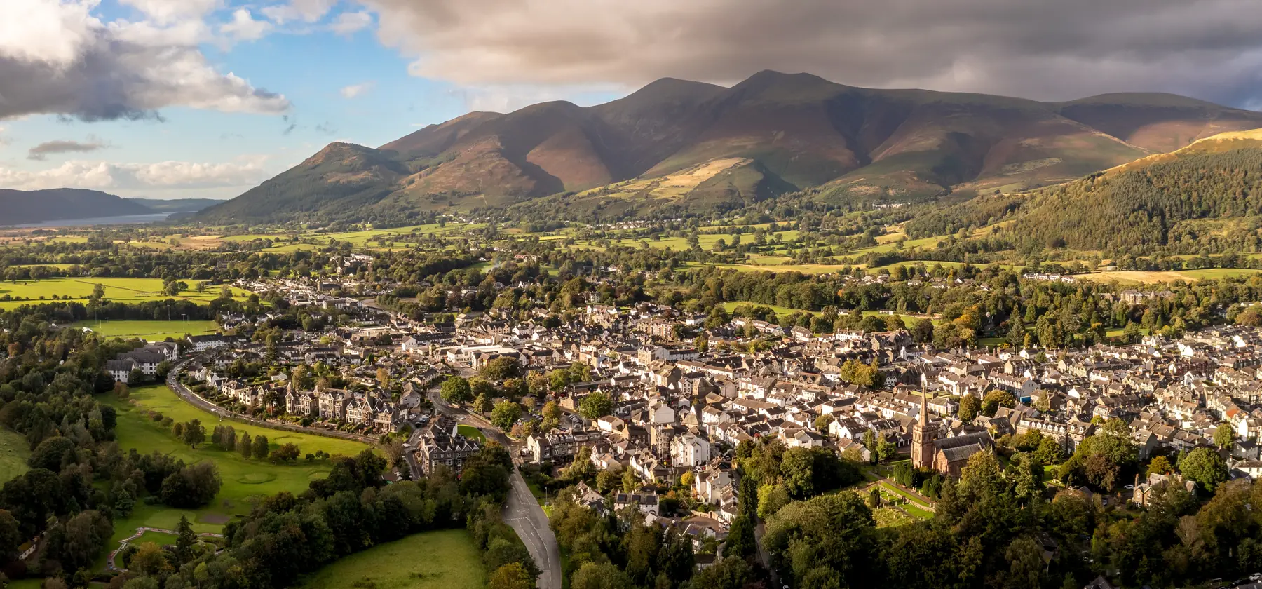
Keswick is one of the few Lake District towns where you do not need a car to get on a good walk. The lake shore is a ten-minute stroll from the Moot Hall, the fells rise straight out of the back of the town, and the Keswick Launch will drop you at a jetty on the far side of Derwentwater so that the walk back becomes the day out. What follows is arranged by effort rather than by fashion, starting with the walks you can do in trainers after lunch and ending with the ones that need boots, a map and a look at the forecast.
Distances below are measured from the town centre. Cumbrian weather does what it likes with all of them: a route that is a gentle amble in June can be a stream in November, and the fell tops hold cloud long after the town has cleared.
The classic. From the Moot Hall it is about fifteen minutes down Lake Road, past the boat landings, to a wooded promontory that pushes out into Derwentwater with Borrowdale opening up beyond it. The path is surfaced most of the way and the crag itself sits barely a mile from the centre. It is deservedly the most-photographed view in the northern Lakes, which means the bench at the end is often occupied — visitors regularly report waiting their turn, and equally regularly report that the wait was worth it.
Carry on past the crag and the shore path continues through Great Wood and Calfclose Bay, so you can turn a fifteen-minute walk into a two-hour one without ever climbing anything. Read more about the promontory on our Friars Crag page.
Barely half a kilometre from the market square, Hope Park is the link between the town and the lake, and the flat circuit through it and across Crow Park to the shoreline is the walk most visitors do first without realising they are doing a walk at all. Crow Park’s bare grassy rise gives you the whole lake and the Borrowdale fells in one turn of the head. Both are level and pushchair-friendly.
Roughly two and a half kilometres east of town, this is a walk with a destination. The circle sits on a shelf of ground ringed by fells — Blencathra to the north, Helvellyn away to the south-east — and the setting does more of the work than the stones do. You can drive and park in the lay-by, but the walk out along Springs Road and up through the fields is the better approach and takes about forty-five minutes each way. Full background on our Castlerigg Stone Circle page.
The gentlest real fell in the area. Latrigg is the grassy hump directly behind Keswick, and the standard route zig-zags up from Spooney Green Lane through woodland before opening onto a broad summit ridge. The reward is out of all proportion to the effort: the whole town below, Derwentwater laid out end to end, and Skiddaw’s bulk rising behind you. Allow two to two and a half hours from town. There is a small car park at Gale Road that removes most of the ascent if you are short of time or legs.
The other half of the pair, on the eastern side of the lake. Walla Crag is reached through Great Wood or up the beck from Springs Farm, and it delivers the single best aerial view of Derwentwater and its islands. Around three hours round trip, with one steady pull and a short rocky section near the top. Ashness Bridge and the drop down to the shore make a satisfying loop back if you have the time.
The most popular fell in the Lake District and, on an August Saturday, it feels like it. Catbells is a shapely ridge on the western side of Derwentwater with two scrambly steps that are simple in dry weather and greasy in wet. The pleasure of doing it from Keswick is the approach: take the Keswick Launch across to Hawes End, walk up and along the ridge, then drop to Hause Gate and return along the lake shore or by boat. Regular visitors treat the launch as part of the route rather than a novelty, and it saves the parking problem entirely — the roadside spaces below Catbells fill early and stay full.
England’s fourth-highest mountain sits directly above the town, and the tourist path from Gale Road is a long, steady, relentlessly uphill grind rather than a technical challenge. Six to seven hours from Keswick, considerably less if you drive to the car park. It is exposed near the top and the summit ridge is a poor place to be in cloud without a compass; the mountain’s easy reputation is exactly why it catches people out.
South of the lake the valley narrows into Borrowdale, and this is where the walking becomes genuinely varied. The National Trust’s Bowder Stone — a house-sized boulder with a ladder up it — sits near Grange, and from the same road you can climb to Watendlath, a hamlet with a tarn at the head of a hanging valley about seven kilometres from Keswick. Surprise View, on the road above, is the viewpoint people find by accident on the way down and then talk about for years; the approach road is steep and narrow, and not one for a large vehicle.
Whinlatter Forest, above Braithwaite and around six kilometres out, is England’s only true mountain forest and the best wet-weather walking near Keswick — waymarked trails through the trees, a Go Ape course, and enough tree cover that a shower is an inconvenience rather than a washout. Push a little further west and Buttermere, eleven kilometres away, offers what many people consider the finest low-level circuit in the Lakes: a flat four-and-a-half-mile loop around the lake with Fleetwith Pike at the far end and Moss Force waterfall on the pass above.
Parking. Keswick’s central car parks fill by mid-morning in season. Lakeside and Central are the closest to the shore paths; the National Trust’s Great Wood car park on the Borrowdale road is the sensible start for Walla Crag and the eastern shore. We have gathered the free options, the paid ones and the charge points in our guide to parking in Keswick.
Boats. The Keswick Launch runs a circuit of Derwentwater jetties, and using it to start or finish a walk is the local habit rather than a tourist gimmick. Hawes End for Catbells, Ashness Gate for Walla Crag and Watendlath, High Brandelhow for the western shore.
Bikes. Several hire shops sit within a few hundred metres of the market square, including electric bike specialists, and Whinlatter has purpose-built mountain bike trails if you would rather ride than walk.
Kit. Boots for anything above Latrigg, and waterproofs for everything. Keswick’s Main Street has an unusual density of outdoor shops for a town of four and a half thousand people, which tells you something about how often people arrive underprepared.
Spring is the best-kept secret. The fells are green, the waterfalls still run from winter rain, the daffodils are out at Ullswater, and the paths are far emptier than in August. Bring a hat anyway — the tops can be under snow into April.
Summer brings long evenings, which is the real advantage: a fell walk started at five o’clock avoids both the crowds and the heat, and the light on Derwentwater at nine in the evening is the best of the year. It also brings midges to the wooded and boggy sections, and full car parks everywhere.
Autumn is the connoisseur’s season. The Borrowdale woods turn, the light goes low and gold, and Buttermere and Watendlath look their best. Days shorten quickly — by late October you need to be off the tops by four.
Winter transforms the high fells into a genuinely serious environment. Skiddaw, Blencathra and the Helvellyn range in snow require an ice axe, crampons and the knowledge to use them; every year people get into trouble because the walk they did in July looked the same on the map. The low-level routes, though — the shore path, Whinlatter, Buttermere, Castlerigg — are at their quietest and most atmospheric, and the pubs have fires going.
Mountain Rescue in this valley is busy, and the pattern of call-outs is consistent: people underestimate the time, run out of daylight, or lose the path in cloud. Four habits prevent nearly all of it. Carry a paper map and a compass and know roughly how to use them, because phone batteries fail in the cold. Tell someone where you are going. Check the mountain forecast rather than the town forecast — they are frequently different. And be willing to turn round, which is the hardest one.
Hope Park to Crow Park and the lake shore — level, surfaced and under a mile. Friars Crag is the easiest walk with a proper view.
Yes. The full circuit is around ten miles and takes four to five hours, with a short stretch of road walking near Grange. Many people walk half and take the launch back.
Latrigg if you want a short, safe introduction; Catbells if you want the ridge walk everyone talks about and do not mind company.
Almost all of them. The shore paths, Latrigg and Whinlatter are popular with dog walkers, though sheep graze on the open fell and leads are expected.
Ready to plan the rest of the trip? Our things to do in Keswick page covers what to do between walks, and where you base yourself decides how much of the day is spent getting to the start of a walk.